
Who doesn’t love a good mystery? I know I do (being married to the brains behind https://classicmystery.blog will do that to you). Here’s a new Oldnall End mystery that’s currently occupying my thoughts, and which I’m looking forward to trying to solve…
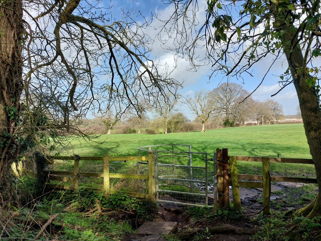
Now, I’ve probably walked through the field above a dozen times this year. It’s on one of my regular Oldnall End walking routes, between Barretts Lane and Old Waste Lane. Squint at the right-hand photo and you can see HS2 on the horizon 😠. It’s recorded on the 1839 Tithe map for Berkswell as no. 938, Garlington Meadow (2A 1R 16P), belonging to Penelope Reeder/Reader, who owned a farm on nearby Meeting House Lane. So far, so straightforward…
Then a couple of weeks ago I visited Warwickshire County Record Office to spend some time with the exquisite Berkswell Enclosure map (permission to show you extracts pending…). The Enclosure map, drawn up in 1802, shows this field as part of a larger parcel of land belonging to Catherine Barratt (nee Thompson, formerly Paynter), a local landowner who had several other holdings in Oldnall End, although I’d never come across a reference to her owning this one. But interesting as it was to learn that Catherine had even more land than I thought, that wasn’t what captured my attention.
Today Garlington Meadow is a field, accessed down a long track from Old Waste Lane, between Field Cottage and Laburnum/Melrose Cottages. In 1839 Garlington Meadow was a field, accessed down a long track from Old Waste Lane between the same cottages. But in 1802… When I located the track on the Enclosure map, I was gobsmacked to see that instead of leading to a field, it led to a whacking great house, sitting right in the middle of Garlington Meadow. There’s no house there now. There was no house there at the time of the Tithe Map in 1839. But in 1802, according to the Enclosure map, there was a house. Consider me intrigued…

You can see the track in question in the photograph on the left. It appears on the Tithe Map as a relatively substantial track, which comes to a sudden halt on the boundary with Garlington Meadow – as indeed it does today. Look dead centre on the photograph and you can just about make out the gate that leads into the Meadow, crossing a small but excitable stream. You wouldn’t get a vehicle down the track today, but the line of the older trees is set back a couple of feet to either side, so I’m certain it would once have been wide enough for carts.
The (exquisitely-drawn and coloured) Enclosure map is minutely detailed. It shows every tree, every gate, every pond, and every building – coloured red for residential and black for others (e.g. barns, hovels, huts). From my knowledge of other buildings depicted on the map, I’m confident that the cartographer reflected their footprints with a high degree of accuracy. This means we can make an educated guess about the location, size and shape of the house on Garlington Meadow.
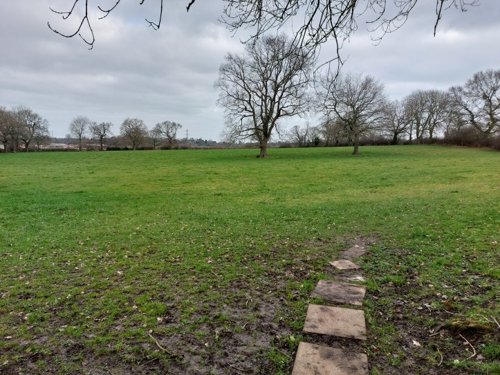
According to the map, our house (can I call it Garlington House?) was situated more or less at the end of the line of stones on the photo below. If you look closely, you can see a lighter-coloured, broadly oval-shaped patch of ground between the stones and the trees. It’s a depression, very broadly the same orientation and shape as the house on the map. It might just be my local history goggles or a strong dose of wishful thinking, but it looks to me like the right footprint.
The map shows Garlington House coloured red for residential, with a separate black-coloured building behind, perhaps a barn. The main house is depicted as L-shaped with a long (3-unit) front range, an additional rear unit on the left-hand side, and a prominent front porch. That’s not an unusual footprint for an early house, if we follow the evidence outlined in Nat Alcock’s wonderful study of nearby Stoneleigh Village, People at Home.
What kind of house are we talking about? It probably had a downstairs hall, parlour, buttery or kitchen and perhaps a dairy or cheese chamber to the rear. It might have had additional sleeping or storage rooms upstairs. Following Alcock’s findings for Stoneleigh, a footprint of this kind would likely come under what he calls ‘the middling sort’ – neither as grand as the houses built for the wealthiest, nor as cramped as the poorest cottages. A home suitable for a yeoman or husbandman, who likely farmed the surrounding fields.
So, that’s where we are. In 1802 there was a house here, on land owned by Catherine Barratt. By 1839 the land had been absorbed into the adjacent Reader farm, and the house was gone. No trace remains, other than an unusually wide footpath and a strange depression in a field. Now begins the fun of trying to figure out what happened and, hopefully, bring something of Garlington House and its story back to life. Watch this space!

[…] this year I wrote about my fascination with a mysterious lost house I’d discovered through the 1802 Berkswell Enclosure map. The house, which I nicknamed […]
LikeLike